 |
| View from Rock Mountain. |
The plan was to rendezvous at my friend and his wife's house at 10am and then figure out where to go from there (well, theoretically, they would be pondering overnight and early morning, too). We'd be going someplace in the North Cascades. When I woke on Saturday morning, it was overcast. In general, this is an improvement from rain, but it's no sun, and it still doesn't make for good views.
Our group of six didn't convene until 10:30am. We decided on a destination: Rock Mountain in the North Cascades, off Highway 2, aka, Stevens Pass Highway. We left in two cars at close to 11am. I gazed at the sky, in hopes that it would clear. After two stops (in Sultan for the first car to pick up a NW Forest Pass, which turned out not to be necessary, and in Skykomish to pick up cooking twine to serve as a shoelace), everyone in the car I was in had finished eating our lunches, it was sunny, and we had arrived at the trailhead.
Our route up Rock Mountain would be via the Rock Lake trail. The trailhead lies beyond a clump of WDOT transportation buildings amid crackling power lines. A random thing I discovered in the Shenandoahs a few years ago was that crackling power lines give me headaches. My brain must be on the same frequency or something.
The trail guide described a 4000 foot ascent up 95 switchbacks on a southfacing slope. I still kind of suck at doing the whole 1000 foot ascent in 1 mile thing. I'd like to attribute this day's cause to (1) having inadvertently rehydrated from yoga the night before with wine (detox and retox) and (2) the really toasty sun. But, the reality is, I'm just not as fit as most people west of the Cascades. That means that the woman in our group who was 4 months pregnant was having an easier time than I was. Sigh.
The trail guide described a 4000 foot ascent up 95 switchbacks on a southfacing slope. I still kind of suck at doing the whole 1000 foot ascent in 1 mile thing. I'd like to attribute this day's cause to (1) having inadvertently rehydrated from yoga the night before with wine (detox and retox) and (2) the really toasty sun. But, the reality is, I'm just not as fit as most people west of the Cascades. That means that the woman in our group who was 4 months pregnant was having an easier time than I was. Sigh.
The trail steeply ascends, so even though the power lines were apparent, we soon climbed above them. After the switchbacks, the trail contours to the east, into much-needed (for me) tree cover. By now, the elevation is over 4000 feet, and the pitch is less steep. I no longer felt like my head was going to explode from being overheated. Or like I was going to vomit, which is how I felt at least 3 times. I'm telling you, I am a flatlander wimp.
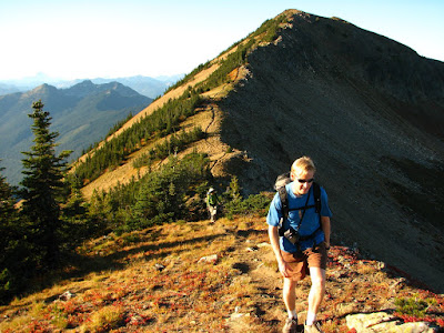 |
| View towards the true summit of Rock Mountain. |
The trail was now lined with blueberry shrubs (which makes me wonder if they were blueberry or huckleberry or some hybrid). Some berries were edible. Others were kind of tart. The forest thinned, and through the trees, we were treated to views across the valley. The trail then entered meadows and met a junction. To the right (and down) was Rock Lake, which couldn't be seen from where we stood. Actually, we asked a guy descending the trail where the lake was, and he whipped out his iPhone, saying he created an ap that would help us out. And sure enough, it did. "It" was Topopoint. Think GPS plus USGS topo map. Seriously, it's stuff like this that endear me to this area. He stopped to chat with us a little longer, asked us if we heard whistles (we did, later, and attributed them to marmots), pointed out the trail to the lake and the one up to the summit, and then with a wave said he needed to get home. Sort of like St. Nick. I digress.
Instead of going to the lake, we headed up towards the summit. We arrived at the top of the ridge. From here, the trail to the right heads to the true summit (6,852', according to the Washington Trails Association writeup). Instead, we headed left and found a precipice on which to sit and refuel. It was about 5:10pm.
 |
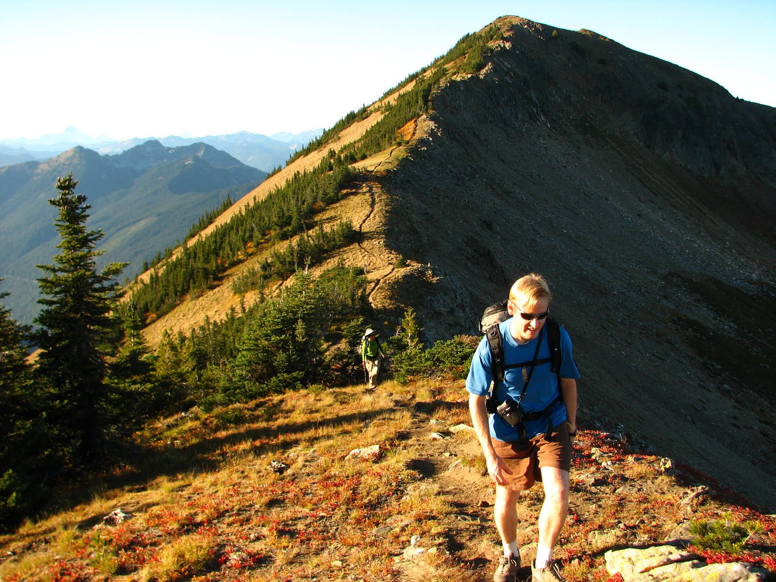
| Descent. |
The plus side of being here this late in the day is that the light was simply fantastic. As were the views. It may have been overcast back in Seattle, but out here beyond the rain shadow, it was gorgeous. I know that all mountain ranges do this, but when I see the Cascades from this perspective,I'm always amazed at the "wave" after "wave" of mountains. Swoon.
Sadly, a little before 6, we left our perches and headed back down. On the way we saw a bear across the way -- it comes up as a speck on my photo, so no post of it. Everyone was back at the trailhead by 8pm, and it was time for margaritas and burritos. Olé!