Showing posts with label hiking. Show all posts

Sunday, May 8, 2011

Tux Redux

Then: On the Sherby, April 25, 2009
In late April, I headed to New Hampshire for the first time in two years.  Actually, it was almost two years to the day of when I had first gone to Tuckerman Ravine, most definitely got my tush handed to me on a platter on the climb, and through sheer willpower alone skied Left Gully without major mishap.   Note to the uninitiated: heavy alpine skis are fantastic on the downhill, but are wicked heavy on one's back.  Just sayin'.

The plan this time was to fly up to Manchester early Friday morning, and because the weather forecast for Friday was more promising than Saturday's forecast, drive straight up to Pinkham Notch and skin or hike up either the Gulf of Slides Ski Trail or the Tuckerman Ravine Trail, respectively. Oh, and also to bring my alpine touring setup, which was at least four pounds lighter than my alpine setup.

It turned into a gorgeous day on the drive into the mountains.  The overcast skies in Manchester had turned into bright sun, Santana was on the satellite radio, and the sunroof on my unexpected upgrade rental car was open.  Can it get better than that??   (Answer: yes)

I arrived at Pinkham Notch at noon.  Not ideal, of course, but on the other hand, five hours earlier I was in Washington, D.C.  The overflow lots were packed and cars lined Rt. 16.  Apparently, half the world had listened when the prior day's avalanche report advised taking a sick day on Friday.
Now: Obligatory Bowl from HoJo's photo, April 22, 2011.
By 12:40, I was on the TRT, hiking.  I'd wanted to do Gulf of Slides, but I opted for the TRT because it was a known quantity, and I was low on fuel (see lunch contents below).  My pack was lighter than it was in 2009, which is to say it was less than 1/3 of my body weight.  Phew.  It translated into being 30 minutes faster on the ascent to HoJo's and arriving just before 2:10.  I even passed eight people on the way up.  This is HUGE.  If you've ever climbed with me, you know that I am sloooow on the uphill.

If I had planned things better, I would have had more than a vending machine-sized package of peanut M&Ms (which I had actually eaten on the drive up), an apple, a Luna Bar, and 2 energy chews for lunch, and I would have gone into the Bowl to hang out with the 1500-2000 or so people that were estimated to be there. Instead, I skied down the Sherby, which was in pretty decent condition save for the last twenty feet, and called it a lovely day.

Monday, December 27, 2010

You're only lost if you don't know where you are

Back in November, I took a navigation course with the Seattle-based Mountaineers, which seems like a pretty cool organization, other than the fact that when I arrived 15 minutes early to the evening portion of the course on a school night, the room was already half full of eager beavers gathered around tables, marking things off on their USGS quads, and not talking to each other.  And I thought I was early.  Jeez.  It got worse - on the day of the practical portion (which I opted to do on the day that Daylight Savings ended so that my 4:30am wake-up call would really feel like 5:30am), I inadvertently arrived a blistering 45 minutes early to the trailhead....and several participants -- not instructors -- were already there.  Wow.

After all that, though, I think you all should know that while I may not be able to figure out where I am in the backcountry, the course taught me how to be wicked good at following a bearing.  I think that still leaves me lost.  :)

Sunday, October 10, 2010

Somewhere over the Rain Shadow

Part of the lexicon in the Pacific Northwest: Rain shadow.  Sun break.  4000 foot gain. 

View from Rock Mountain.
Late one Friday, I received an email from a friend, inviting a group to go hiking the following day. Actually, that Friday, I received emails from three people about going hiking over the weekend.  After a week of rain in Seattle, the forecast called for sun, and like those who are deprived of some desirable thing for too long, people were clamoring to head outside at the first prediction of sun on a weekend.

The plan was to rendezvous at my friend and his wife's house at 10am and then figure out where to go from there (well, theoretically, they would be pondering overnight and early morning, too). We'd be going someplace in the North Cascades. When I woke on Saturday morning, it was overcast. In general, this is an improvement from rain, but it's no sun, and it still doesn't make for good views.

Our group of six didn't convene until 10:30am. We decided on a destination: Rock Mountain in the North Cascades, off Highway 2, aka, Stevens Pass Highway. We left in two cars at close to 11am. I gazed at the sky, in hopes that it would clear. After two stops (in Sultan for the first car to pick up a NW Forest Pass, which turned out not to be necessary, and in Skykomish to pick up cooking twine to serve as a shoelace), everyone in the car I was in had finished eating our lunches, it was sunny, and we had arrived at the trailhead.

Our route up Rock Mountain would be via the Rock Lake trail.  The trailhead lies beyond a clump of WDOT transportation buildings amid crackling power lines. A random thing I discovered in the Shenandoahs a few years ago was that crackling power lines give me headaches. My brain must be on the same frequency or something.

The trail guide described a 4000 foot ascent up 95 switchbacks on a southfacing slope. I still kind of suck at doing the whole 1000 foot ascent in 1 mile thing. I'd like to attribute this day's cause to (1) having inadvertently rehydrated from yoga the night before with wine (detox and retox) and (2) the really toasty sun.  But, the reality is, I'm just not as fit as most people west of the Cascades. That means that the woman in our group who was 4 months pregnant was having an easier time than I was.  Sigh.

The trail steeply ascends, so even though the power lines were apparent, we soon climbed above them. After the switchbacks, the trail contours to the east, into much-needed (for me) tree cover. By now, the elevation is over 4000 feet, and the pitch is less steep. I no longer felt like my head was going to explode from being overheated. Or like I was going to vomit, which is how I felt at least 3 times. I'm telling you, I am a flatlander wimp.

View towards the true summit of Rock Mountain.
The trail was now lined with blueberry shrubs (which makes me wonder if they were blueberry or huckleberry or some hybrid).  Some berries were edible. Others were kind of tart. The forest thinned, and through the trees, we were treated to views across the valley. The trail then entered meadows and met a junction. To the right (and down) was Rock Lake, which couldn't be seen from where we stood. Actually, we asked a guy descending the trail where the lake was, and he whipped out his iPhone, saying he created an ap that would help us out.  And sure enough, it did.  "It" was Topopoint. Think GPS plus USGS topo map. Seriously, it's stuff like this that endear me to this area. He stopped to chat with us a little longer, asked us if we heard whistles (we did, later, and attributed them to marmots), pointed out the trail to the lake and the one up to the summit, and then with a wave said he needed to get home. Sort of like St. Nick. I digress.

Instead of going to the lake, we headed up towards the summit.  We arrived at the top of the ridge. From here, the trail to the right heads to the true summit (6,852', according to the Washington Trails Association writeup). Instead, we headed left and found a precipice on which to sit and refuel. It was about 5:10pm.

Descent.
The plus side of being here this late in the day is that the light was simply fantastic. As were the views. It may have been overcast back in Seattle, but out here beyond the rain shadow, it was gorgeous. I know that all mountain ranges do this, but when I see the Cascades from this perspective,I'm always amazed at the "wave" after "wave" of mountains.  Swoon.

Sadly, a little before 6, we left our perches and headed back down.  On the way we saw a bear across the way -- it comes up as a speck on my photo, so no post of it. Everyone was back at the trailhead by 8pm, and it was time for margaritas and burritos. Olé!

Tuesday, September 21, 2010

Where is this lake of which you speak?


We capped off the day with sushi that arrived on conveyor belts. What better way to refuel post-hike than with sushi that magically appears before you and prior to that, a Cascadian Farms ice cream made from fresh fruit??  Indeed, I did just this after returning from the North Cascades Hidden Lake Lookout with a yogini pal in August.
Hidden Lake.


This is one trail where you realize that even if you are hardcore by east coast standards, you are really just mediocre at best by PNW standards.  And by "you," I mean "me."  From the trailhead, the trail enters an old growth forest and ascends before entering alpine meadow that was recently popping with wildflowers.  And steeply ascending via switchbacks.  It's entirely possibly that the wildflowers were still wildly popping, but I was too busy trying to breathe to notice.  La Yogini, on the other hand, was in decent shape, so she oohed, ahhed, and WOWed at the scenery for the both of us as we trekked out of the meadow, scooted over slide scree, contoured around the mountain, avoided snow bridges, moved up a boulder field and finally, kicked up a snowfield to find....a hidden lake!  And a 300 foot climb from there, stood the cutest lookout ever, and where two of my friends spent the night several yeas ago.  Views were amazing; they would have been super amazing if the skies were clearer.

The trail is out and back, and even though we saw everything on the way up, it's just as stunning on the return.  Once at the trailhead, I lamented that the Cascadian Farms stand was probably closed...it was, after all, close to 6pm.  Never fear, folks, it's open until 8pm in the summer.

Sunday, September 19, 2010

For all the Tigresses

Huge shrooms in this climate.
This past Saturday, my pal who is now nicknamed "SAR" on this blog and I decided to meet up at the Tradition Plateau Trailhead of Tiger Mountain State Park in the Issaquah Alps (aka, Exit 20 off I-90).  SAR and I met a few years ago through an online forum for women skiers.  In the summers, SAR worked in the National Parks, and in the winters, she was a ski patroller.  She now just does the latter  (and pays the bills with a 9-5 job like the rest of us).  In her spare time, she's a volunteer firefighter and search and rescue team member.  She carries about four pagers with her at all times.  Yeah...she's a good asset if you decide to deviate from the normal route in the woods.

On Saturday, we both were running late.   Usually this is not good when heading to the general Tiger Mountain area -- a few weeks ago when I was driving by on the interstate, the frontage road to the trailheads was lined with cars, and I thought there was a concert or some other event going on.  Alas, it had been raining for four days straight, and even as I drove out of the city, I hit a rain shower.  I truly thought we'd spend our entire time in the rain.  Suffice to say, it was a safe-ish bet that at 9am, there would be parking at the trailhead parking lot (fits approximately 80 vehicles).

SAR and I decided to summit West Tiger 3.  There are three Tiger peaks: West, East and South.  West then has three more peaks, 1, 2 and 3.  West Tiger 3 is by far the most popular and what most people speak of when they say they are "hiking Tiger."  In reality, the area is chock full of trails, and to the extent that one wants to take a trail less traveled, she would be best served to bring her own map.  Just sayin'.

Our walk up the West Tiger 3 trail was uneventful.  It was SAR's first hike in a while, and she had torn a calf muscle earlier this summer.  So we considered the hike a test of her gams.  As for me, after weeks of doing trails with 1000' gains over a single mile, I was thrilled to be gaining 2000' over 2.5 or more miles.  For what it's worth, I am still the slowest person walking up the hills downtown.  I mean, women in heels cruise by me in the urban jungle.

At the summit, we were greeted by mist and fog and the sun trying to break through.  We took the obligatory photo by the summit sign and ate an early lunch.  SAR feasted on a bagel with turkey hot dogs sliced lengthwise and pickle relish as I ate my pb&j, where the bread was leftover tandoori roti from earlier in the week.  Suffice to say, our cupboards were not stocked.  A shaman then appeared at the summit.  Okay, he just looked like a shaman, with a long white beard and a staff with an eagle on top.  And he declared it took him 1 hour and 4 minutes to summit, which was not bad, but he's done it in under an hour.  ("We have shorter legs," SAR said to me as I mumbled, "Overachiever.")

Next, a pair of women (one in jeans and a white shirt, the other in black capri pants and a red shirt -- I think.  All I really remember are the jeans) wandered to the summit and wondered how they missed the Poo Poo Point turnoff.  Okay, this was my first time here, but the second I looked at SAR's map, it was apparent there was no turnoff to Poo Poo Point from where we were.  I mean, these women didn't even start at the correct trailhead to get there, unless they intended to do a 9-mile round-trip hike.  We pointed them in the direction of the trail they would have to take if they wanted to go to Poo Poo Point, and minutes later, as SAR and I were looking at the map to determine where we wanted to go, the women returned and said, "It looks really narrow there....are you sure that's the trail?"  Uh, aren't most trails single track?

Mossy trees on the TMT
The reality is, trails in the area alternate from very well identified to not marked at all.  Several trails depart the summit, and there's little way to discern which trail is which without an understanding of which direction you're facing.  We decided to make a loop and take the "really narrow" trail that the women turned back from: Tiger Mountain Trail to the Seattle View Trail to the West Tiger RR Grade Trail, back to the West Tiger 3 Trail.  Except, the Seattle View Trail is not marked at all, and we waltzed by thinking it was a trail leading to a viewpoint.  And because we missed that cutoff, we turned our ~6-mile hike into a 9-mile sprint (we had a time constraint) through misty old-growth forest (complete with soft ground!), overgrown scratchy fauna, and delicate spiderwebs.  On the plus side, the sun popped in and out of the clouds and we encountered only two other people -- they were geocaching -- on this route: TMT to One View Trail to West Tiger RR Grade to West Tiger 3.   The junctions of TMT/One View Trail and One View Trail/West Tiger RR Grade (and even the junction of Section Line Trail and West Tiger RR Grade) are all very well-marked, which is why it's surprising that there was a lack of signage for other intersections.....like TMT to the Seattle View Trail that we missed.  Upon emerging from the West Tiger RR Grade, we saw that it wasn't marked off of West Tiger 3, either.  Curious.  Once back on West Tiger, which is a broad path, it was another mile or so to the trailhead.  Families, groups, and trail runners headed uphill as we came down.  We returned to a mostly full parking lot...and I was only 40 minutes from home.  Superb.

Map of the area.

Photos from the trail

Before I came out to the Pacific Northwest, everyone raved to me about the summer weather.  Since then, even the natives have been traumatized by the unseasonably cool, and now, wet (read: non-existent) summer.  Like Lewis and Clark, I and my hiking companions -- a lovely yogini from DC (Hidden Lake Trail) and the most hardcore woman I know who is, incidentally, too hardcore for a single nickname but will be known as SAR, short for Search and Rescue, which is one of the bazillion hardcore things she does (Tiger Mountain) -- forged on ever ho.  For several weekends, I made it into the North and Middle Cascades for a few hikes.  I wound up spending a lot of time in the clouds and mist.


Hidden Lake Trail, North Cascades

Bandera Mountain, Middle Cascades
SAR, on the Tiger Mountain Trail, Middle Cascades


Thursday, August 19, 2010

Mt. St. Helens and an Homage to My Second Grade Teacher

I was barely 5 when Mt. St. Helens erupted, and I lived on the east coast. So, the first time I remember hearing of the eruption was two years after the fact, when I sat at my wooden desk in Mrs. Haak's second grade class, and twenty-four seven-year-olds passed around a jar of ash from the eruption. The story, as I remember it, is that her brother lived out in the general eastern Washington, northern Idaho, Montana area, and either he sent her the jar, or she went out and visited him and collected the ash herself.
Mt. St. Helens.
I thought a lot about Mrs. Haak this weekend because I drove down to Mt. St. Helens. Usually the story where she comes up is the one where I tell people that I went on a health kick in second grade. I can't remember which came first....a math unit on...numbers (and reading nutrition labels)? Or a science chapter on health? Actually, neither of them really seem plausible. I think Mrs. Haak was just into a healthy lifestyle, and she taught us how to read nutrition labels, specifically, the sugar content. Thanks to her, I convinced my mom to buy a box of Grape Nuts, and then I nearly broke my teeth trying to eat a mouthful (to this day, I have never purchased another box of Grape Nuts). Two other things come to mind when I thought of Mrs. Haak this weekend:  Frank Shorter and Beezus & Ramona Quimby.

Frank Shorter, before he trained for and won the Olympic Marathon, grew up in a town not far from where I grew up. Well, because the town where he grew up was where we bought our groceries and nearly every other household item, it essentially is my hometown. Anyway, he was a big deal in town in the early '80s, and to Mrs. Haak.  Running for fitness was all part of the healthy lifestyle that she was trying to instill in us.

As for Beezus and Ramona, Mrs. Haak would read chapters of Beverly Cleary's books about the sisters during quiet time, which was neither recess nor work time.  (It wasn't Purgatory, either, if that's what you were thinking.) I find this memory rather poignant because a movie about the Quimby sisters is playing in theaters right now....

Back to the present. My drive to Castle Rock, WA, the gateway to Mt. St. Helens, lasted close to three and a half hours, so I had lots of time to think.  I tried to compare Mrs. Haak to other elementary school teachers that I had.  Being me, I actually could remember the names of all my teachers, but I couldn't remember anything extraordinary about them that I still carried with me. Yet, I could remember at least three things about Mrs. Haak that have resonated with me at one time or another in my life. Well, now four, seeing as I finally made it to Mt. St. Helens.

A former roommate, Charlotte, and her husband, Aaron, now live in Bend, OR, and we all met at Seaquest State Park, just outside Castle Rock, where we spent Friday night before driving up to Johnston Ridge Observatory on Saturday morning. Although we had planned long in advance to backpack near the Monument, we didn't finalize our plans until Friday morning. Unable to get permits to climb St. Helens itself, and having another permit request caught in limbo, Aaron chatted over the phone with a ranger and got us a camping permit for Dome Camp, off the Boundary #1 trail in the Mount Margaret Backcountry.

Permit in hand from the rangers at the Johnston Ridge Observatory, National Parks passport stamped, a little rearranging and distribution of gear among us so that I wouldn't be carrying 45% of my body weight, and then we set off up the Eruption Trail (the paved path for more leisurely Monument visitors) just for kicks and then merged onto the Boundary #1 trail.  By the way, this past weekend was possibly one of the hottest in the area recently, hitting the low to mid 90s in Seattle and who knows what elsewhere. The Boundary #1 trail is not particularly shaded, but on our way out, there was a decent breeze. Anyway, the trail crosses in "front" of the crater and then contours around a hill. Oddly, this single track would seem wider on the way back, but on the way out, it seemed insanely narrow, especially as people came toward us. The trail wends its way over and around hills. As for the trail surface, it was essentially soft ash/dirt.  My ankle flexors are still sore from the workout they got.
Charlotte & Aaron on the trail.
As we hiked, Mt. Hood to the south emerged, as did Mt. Adams to the west. The tip of Mt. Rainier made cameo appearances, and at one point, you could pan a 180 degree arc and see all three, plus St. Helens, of course. What a treat! There are also views of Spirit Lake, which was drastically altered after the 1980 eruption. The trail contours into some hills above the deep pool of St. Helens Lake (I'm pretty sure that's what it is), and Aaron was pretty taken with the patterns made by the scorched tree trunks floating in both St. Helens Lake and Spirit Lake. 

Aaron is an outdoor recreation instructor, which is rarely a bad person to have along in the backcountry. Particularly when you're eating wild huckleberries and wild strawberries. Actually, I think that huckleberries are wannabe blueberries, but that's just me. At any rate, you don't want to be eating the fruit next to the non-poisonous one and then turn the page of your naturalist guidebook only to discover that you've pulled a Chris McCandless. That'd put a damper on things. So, Aaron declared one particular wild strawberry patch the BEST WILD STRAWBERRY PATCH he'd ever seen. Me, I'd never seen a wild strawberry patch, so I'm taking his word for it.
THE BEST WILD STRAWBERRY PATCH EVER!
We arrived at Dome Camp just before 7pm, and what a view! One of the great things about this campsite is that there are only 2 sites available, and I think a maximum of 4 people allowed. It took us some time to figure out where exactly the tent platforms were – the map the ranger gave us wasn't a topo and only depicted two tent platforms separated by a toilet. It turns out that one tent platform was downhill from the composting toilet and the other was probably 300 feet uphill. I mean, UP hill. And the penthouse tent platform was in ill repair  only three beams and a PVC pipe denoted that it was the site. 
 The orange tent is on one tent platform, and 
the photo is taken from the other tent platform

But WHAT A VIEW! And a perfect site to watch the Perseids meteor shower, which had peaked the night before. The only downside was the unexpected light pollution from Olympia and the wind. I've no idea if the wind is a usual occurrence, but brrrrr! Oh yeah, and flying ash everywhere. Bring sunglasses or some other protection for eyes from ash/dust if you're out this way.
The next morning, before anyone else woke up, I walked up the hill behind my tent to see what was there: more trees that had been knocked down in Mt. St. Helens' lateral blast, and instead of a USGS medallion, a USDA/USFS Camera Point marker. I've no clue what that is, but here's a photo. 
Another treat:  right before we headed back out onto the trail to return to the trailhead, Aaron spotted mountain goats headed up a far ridge.  Holy cow, what a good eye!
Hey!  It's the Backcountry.com logo!  In real life!
Nothing out of the ordinary occurred on the way back in. We gazed at both of the lakes and longed to take a plunge. You know, other than the fact that it would be a huge climb back out onto the trail. The return hike back to Johnston Ridge seemed shorter, and I do think that there are slightly more downs than ups on the way back in. Which is good for me since I hate going uphill for no reason.  Good thing there was a view at the "top!"

Sunday, January 10, 2010

3 Fierce Women and I take on the Grand Circuit at Torres del Paine


The title of this post says it all, keeping in mind that I am not fierce, at least in comparison to these women. During the last two weeks of 2009, Catherine, Ashley, Renee, and I went to Southern Patagonia to Torres del Paine National Park in Chile. Our mode of experiencing the park was to trek what's known as the Circuit, as opposed to the "W." The Circuit is something like 85.2 kilometers, although to be frank, I don't think anyone, including the park officials, knows what the precise distance is. The weather in late December was predictably variable. We hit downpours on the first two days, then sun for a while, some snow – particularly on our way up to Campamento Britanico – and always, the wind. Which is lovely when you lack mass, as I do. Anyway, the map below is scanned in and annotated with our specific journey.
I recommend downloading and then magnifying 
the image to see where we camped, or go here for a 
non-annotated LARGE map.

Accessing the Park from Puerto Natales, Chile, is simple. Puerto Natales, first of all, is easily walkable, and like every other guidebook says, purchasing fuel for stoves is easy. There's also a supermarket in town where last minute food supplies can be purchased. Not as easy (in fact, impossible) is purchasing Snickers bars or other protein energy bars, at least in 2009. On the other hand, it is also impossible getting anything with the word "honey" in it through Chilean Customs/Agriculture Inspection. So, if you're bringing in granola mix with honey listed in the ingredients, it's likely to be confiscated.

Day 1, from Puerto Natales to Park, then Refugio Torres to Campamento Seron, 9k or 4hrs.

A 7am bus operated by Buses Gomez picked us up in front of Casa Cecilia hostel, and after a few more stops, we were on our way to the park. Buses Gomez is a satisfactory bus company – Buses Pacheco, which we had taken from Punta Arenas to get to Puerto Natales, seemed to have newer buses. The Park is about 2 hours away from Puerto Natales; however, for reasons that I was never able to figure out, on the way to the Park, the bus stopped near the Argentinian border for about half an hour. This didn't happen on the return, for what that's worth. Probably because everyone on the bus smelled. More on that later.

The commercial buses drop off at Laguna Amarga. After paying the park entrance fee, which I am nearly positive is different for Chilean citizens than for foreigners, we took one of several mini-buses available from private companies and vary in price from $1000 Ch. pesos to $2500 Ch. pesos one way to a bus stop near Refugio las Torres Central and las Torres Norte. It's also possible to start the trek from Laguna Amarga, crossing a bridge and then turning right onto a trail through grasslands towards Campamento Serón.

From the Refugio las Torres, we were off to Campamento Serón. And it started raining. And we felt like we were in the English country side because the terrain is mostly flat and pasture like. 
Feeling like we're in England right about now...
We arrived at Serón in a downpour. The guy running the place let one of us go in to make dinner, rather than doing so in the rain. We were camping, but regardless, the refugio was not what I was expecting. What can I say – I thought all huts were like AMC huts. I popped my head in there to get water, not realizing there were outdoor sources. I couldn't tell who was in charge of the place, and it basically seemed like a trailer. For campers, there was an outdoor flush toilet, shower and sink available, which is still spiffier than a port o' potty. I would later learn that this was the un-spiffy side of the Circuit.

Campamento Serón, our tent is the yellow one right next to the Refugio,

Day 2, Campamento Seron to Refugio Dickson, 19k or 6hrs.


We first got an idea of the other groups doing the Circuit on this day. We passed and got passed several times by a group of four German guys, a mixed group of Israelis, and a Chilean couple.

Despite the skies clearing before and during breakfast, they opened up again with rain as we packed up and headed out. The trail here is predominantly flat, although there is a minor pass near Lago Paine with a big uphill on some switchbacks. Once you reach the pass, there are immense winds on the downhill. 
Ashley and Renee approach the pass near Lago Paine.
From there, the weather became humid, and then entered forested areas, which alternated with more open areas. In fact, when I stopped to tie my shoe, a guanaco appeared behind me on the trail. He galloped around us and then resumed the trail, stopping only to find a grazing spot. Whee!

Friendly guanaco on the trail.

The balance of the day's hike is near water sources. There are a lot of bugs, although not all biting. The trail ascends slightly as it nears Refugio Dickson before very steeply descending to the refugio and campground. From the campgrounds, there are 360˚ views of mountains. There's also a glacier nearby that I never managed to see, but that I could hear calving. Oh, and there are flying biting insects and other insects that fly and generally annoy you without biting. I didn't even try to explore the refugio this time.
View of the Refugio Dickson area on the approach.

Day 3, Refugio Dickson to Campamento los Perros, 9k or 4hrs.


From the Dickson campground, the trail ascends through the woods. It's worthwhile to take a look back every now and then towards Lago Dickson for the view. 
View back towards Lago Dickson.
Shortly afterward, though, the primary views become those to the right, towards Cerro Paine. The rumor on the trail this day was that some groups would be hiking to los Perros while others would go direct over the John Garner Pass. The latter group included a pair of German women who generally intimidated me despite being nice and taking a photo of us.

I don't really remember much about this stretch of trail. I think it was pretty flat until we got beyond a significant waterfall on Rio los Perros, a bridge crossing the river, and then approached a moraine that bordered a silty lake at the bottom of los Perros Glacier. From here, we got a good look at the John Garner pass. The trail took us onto the moraine (where it was windy) for a view of the glacier, then alongside Rio los Perros for a scramble before entering a wooded area and the campground.
Glacier los Perros.
Los Perros campground was the first we came upon that had a dedicated cooking shelter. I figured this meant that the weather was regularly nasty enough to warrant a shelter. Sure enough, even though we had arrived in sunshine, a squall came through maybe 45 minutes later, bringing sideways blowing snow. This, of course, then cleared up for a bit, and I ventured to the old circuit trail – marked with orange blazes (there are signs towards the pass that point in the other direction, and that trail is marked with pink ribbons) – near the river and was greeted with amazing 360˚ views of mountains. WOW.
One of the views from Río los Perros, from Campamento los Perros.
In this case, the shelter was a wannabe yurt – wooden supports that formed a circle around a tree trunk and a tarp/plastic cover over the supports. I've been in geodesic domes that were of similar quality, except I paid more to be in those geodesic domes. There were minor leaks, but it was superior to making dinner in the sleet. There were picnic benches and tables, and a wood stove, inside the shelter, which became full with cold and wet hikers, including the Chilean couple we had run into the day before. Although this couple was rather adorable, I feared for them: they carried a double burner Coleman stove on which they made spaghetti and wore cotton sweatpants, from which you could see steam arising as the couple stood near the stove. Eek.
Renee supervises as Catherine and I prep some delicious 
Mountain House freeze-dried meal in the cooking shelter.

Day 4, Campamento los Perros to Campamento Paso, 12k or 6 hours - 680m ascent, 800m descent.

I knew that I was the weakest hiker in my group. Of course, "weak" is relative because it just so happened that my group included a former pro cyclist. What was I thinking? Anyway, my biggest concern about crossing the John Garner Pass was me being so slow that it would endanger my group. After seeing the Chileans the night before hiking in wet sweatpants and carrying an enormous stove, I felt somewhat better, but really, just because they were unprepared didn't mean I was better prepared or equipped (although I was). Rumors at los Perros were that no one had ever (1) died while crossing the pass or (2) turned back. I, ever the optimist, attributed this to poor accounting and the massaging of statistics. We also learned of other groups' plans for the day. Groups (primarily the four German guys) believed that los Guardas campground – 3hrs and 6k beyond the Paso campground – provided better grounds, so they planned to push through. Our plan was to wake early - 7 a.m. - and be out of the campground by 8:30 a.m. to give ourselves plenty of time to deal with potential catastrophes.

The trail from los Perros entered the woods, and when you've psyched yourself up for crossing a mountain pass, it is beyond weird to be slogging through nutrient-rich bogs. We're talking fireswamp out of the Princess Bride, minus the rodents of unusual size. The trail took us through bogs with mangrove-like trees and up and down drumlins before finally reaching the "bottom" of the John Garner Pass for the final ascent.
Sending the small person first through the bog.
From this approach, the pass is snow-covered and generally marked with wands and the occasional orange-blazed rock. I'm not a speedy climber with or without a pack, but it was particularly demoralizing to see a bunch of crazy ultrarunners flashing the circuit in THREE days pass by wearing skimpy shorts and mini backpacks. Geez. Catherine accompanied me as I slogged up the pass. Winds on the pass weren't constant, but when they hit, they were ferocious. Twice I nearly got blown over – I pulled an armadillo move the second time and fell onto all fours while Catherine's pack cover, which was not secured, blew off into the sunset. And while she was on the summit taking a photo for another group, Ashley's hat and sunglasses blew off her head.
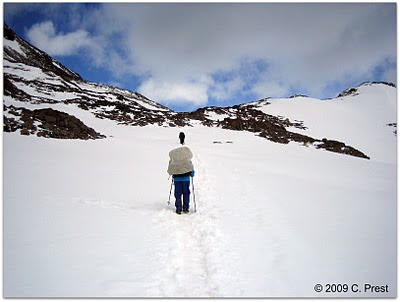
Heading up to the John Garner Pass.
The top of the Pass yielded an amazing view of Glacier Grey, which is something like 17k long and part of the southern Patagonian icefield (Hielo Sur). For as far as the eye could see, it was just glacier. Also while we were on the pass, a straggler ultrarunner followed her guide, who was carrying not only the ultrarunner's gear but also .... a double burner Coleman stove. :)
Views from John Garner Pass toward Glacier Grey.
The trail descends down the opposite side of the pass, through the snow, into a wooded area with steps cut in and a metal banister. I've never been able to understand why these things appear in unnatural places. I've also seen man-made stairs and banisters in Taiwan's Taroko Gorge area and Mexico's Copper Canyon. Regardless, winter doesn't care about man-made stairs and banisters, and while there was still snow on the ground, this setup created a luge track.
Worst glissading technique ever.
Glacier Grey popped in and out of view as we descended numerous steps in the woods towards a season other than winter. A few hardy souls were making their way up. The descent took a toll on our quads and knees; I couldn't imagine doing it in the opposite direction. Ultimately, the distance took us a little under six and a half hours. I'm sure without me, the group would have been faster.

Campamento Paso featured a sparsely wooded area, outdoor tables, a cooking shelter, cut-in tent sites, and a flushable concrete hole in the ground. I'm not sure why someone just didn't bring up a throne - the tank part of the toilet was already there!

Christmas eve dinner consisted of freeze dried meat and veggie lasagna and cut green beans, courtesy of chez Mountain House. Six servings of both were perfect for four hungry chicas. The Chileans who belonged to the Coleman stove, by the way, did eventually show up.


Day 5 - Christmas Day! Campamento Paso to Refugio Pehoe, 21k or 10.5 hours.

Our original plan was to hike to Refugio Grey, 10k or 5hrs, and spend the night there in the refugio and have Christmas dinner and Boxing Day breakfast at the refugio. Then, on Day 6, we'd hike to Campamento Italiano and slack pack up the Valle del Frances to the viewpoint and back, and then continue to Refugio los Cuernos. Instead, we altered our plans in hopes of catching views up at the viewpoint. Day 5 would now consist of a 21k "rest day" hike (HA!) to Refugio Pehoe, closer to the Valle del Frances, and Day 6 would be up into the valley and camping at Campamento Britanico. The hope was that the following day, we'd be able to wake up early and head to the viewpoint before descending down to Refugio los Cuernos.

Between Paso and Refugio Grey, we had views of Glacier Grey on hiker's right and several stream crossings. Some of the streams required ladders to descend or ascend, and one in particular was a rather scary decent. I recommend finding a place to stow trekking poles so as to have a better grip on the ladders. 
Descending one of several ladders.
Before long, we arrived at Campamento los Guardas, where the German guys had spent the night. The campground is at the end of Glacier Grey and appeared to be a more sheltered, and thus, warmer, campground. From there to Refugio Grey was a flat and speedy trek through woods. Refugio Grey is situated on a point on Lago Grey, from which boats depart to take people to the opposite side of the lake and also to the glacier for hikes.
Dealing with the winds as I head away from Glacier Grey.
From Refugio Grey, the trail became exposed and windy in spots. There were more steps on which to ascend, some rocky viewpoints of the lake and glacier (kind of mediocre once you've seen the real deal) and then flats on the approach to Refugio Pehoe. When we arrived, we discovered that we had caught up with the intimidating German women who passed us on Day 3. Words cannot express how thrilled my legs were to finally stop moving. One woman saw me lying in front of the refugio as we were waiting for Catherine to check us in and had the gumption to first say that she sometimes felt the way I looked. Then she asked me how old I was and then declared that I should give it another 30 years and see how I felt then. I was too tired to tell her that I had just carried nearly a third of my body weight 12 miles. And that the day before I ascended and descended the pass. And that the day before that....you get the idea. Of course, I then ran into her twice inside the refugio.
Salvation! Refugio Pehoe! Although, this view is as we departed.
Although I did not enter Refugio Grey when we stopped there for lunch, it appeared from the exterior more like what I think of as a hut. Refugio Pehoe was a contrast (in a good way). It was larger and more modern. And it seemed that most of the people there had arrived by boat from Guardaría Pehoe. At least, they seemed way cleaner and less hungry than us. Refugio Pehoe also serves as the starting point for many people doing the W hike. The four of us got a room of six bunks to ourselves and there were separate showers/toilet rooms for men and women. More importantly, we met up with our friends Eric and Elizabeth (of Walking Barefoot), who were hiking the W as part of their honeymoon.


Day 6, Refugio Pehoe to Campamento Britanico, 13.1k or 4.5hrs.

From Refugio Pehoe, we hiked toward Campamento Italiano to head up to Campamento Britanico. Campamento Italiano is at the bottom of Valle del Frances, and the trail from Pehoe to there was unremarkable. It was so unremarkable that we actually thought we were going the wrong way or missed a turn. The most exciting thing was the suspension bridge opposite Campamento Italiano.
Ashley crosses the suspension bridge.
From Campamento Italiano, the trail ascends up a moraine or otherwise rocky trail. The trail opens into an area with boulders and a view across the valley to Glacier Frances. Looking back down the trail, Lago Nordenskjold and Lago Pehoe are visible. On this day, precipitation decided to grace us, and from about here on out, it was sleet or snow. And the wind, of course. The trail was not consistently uphill because there were a bunch of drumlins and the trail went in and out of the woods. Every now and then, there would be a clearing, but visibility was limited. I'm not gonna lie – there were moments when I lagged so far behind the fierce women with whom I traveled that I was convinced it would be a few hours before another group would come up and find me should I collapse. Not to be dramatic or anything.
Wondering if anyone would find me if I collapsed...
Catherine, Renee, Ashley, and I were the first group in the campground, and the only people we expected were the German guys. It turned out that a group of Americans doing the W showed up as well. Temperatures hovered around 35˚F under my tent fly, and I briefly contemplated the merits of a catheter before dressing to face the elements and to answer nature's call(s). Brrrr....


Day 7, Campamento Britanico to mirador to Refugio los Cuernos, 4k round trip to the mirador and then 11k or 4hrs to los Cuernos.

We awoke to a dusting of snow on the ground and our tents, AND clear sunny skies! We quickly emerged from the tents and made our way up to the mirador for spectacular 360˚ views. 
Campamento Britanico.
Before arriving at the mirador, there was a clearing probably formed by an avalanche at some point. Because the trees were dead, there were wonderful and surreal views. After seeing Glacier Grey from the John Garner Pass, this was the next most amazing part of the hike for me. 
Views from the clearing, which reminded me 
of the Lion, the Witch and the Wardrobe.
From the clearing, we moved up to and beyond the mirador before returning to it. The winds were mild, which was a surprise after the previous day.
View from the mirador.
Eventually, we returned to the campsite for breakfast and then descended down the valley. At the midpoint, we witnessed a crazy avalanche above Glacier Frances. 

And, because the weather was better than the previous day, the views towards Lago Nordenskjold and Lago Pehoe were amazing.
The German guys and Lago Nordenskjold and Lago
Pehoe behind them. I'm probably missing an umlaut.
The descent to Campamento Italiano, like the ascent, is rocky, and care must be taken not to roll one's ankle on the softball-sized rocks. When we arrived, Campamento Italiano was very populated, and the bathrooms were initially difficult to find. Actually, the bulk of the campground is a dump. There, I wrote it. Because of this, corners of the campground became de facto bathrooms. It wasn't until we continued beyond the obvious part of the campground, towards Refugio los Cuernos, when we found bathrooms and other tent setups from people who probably took the time to find better sites.

The distance from Campamento Italiano to Refugio los Cuernos is 5.5k or 2.5hrs according to the park map. The trail here is flat and goes through a wooded area before kissing the shores of Lago Nordenskjold. Sites at the campground are set in mini clearings of the calafate bush. It appeared that the bathrooms in the refugio were available for campers (at least, we used them), and the hut was warm and cozy in the afternoon sun. This was purely a hiker's hut and a lot less flashy than Refugio Pehoe.
$8 for a liter of box wine. Yup.
We discovered a treat: the refugio sold $4000-Ch. peso ($8) liters of wine! Hilariously, this was also the night we learned the names of the German guys whose schedule coincided with ours (maybe the wine was an influence?). Unfortunately, this is when my gut started cramping, and I spent the remainder of the mild night in various forms of discomfort. Everyone else (including Elizabeth and Eric) was in the hot tub(!). Fantastic. Yes, you can feel sorry for me because the next day really sucked.


Day 8, Refugio los Cuernos to Refugio Torres Norte, 11k or 4 hours.

In light of my gastrointestinal distress, I decided to skip the last valley and head to the end of the circuit. This part of the park is in privately-owned land. The refugios here are owned by Fantastico Sur. The rumor is that you can get one refugio to call another to make and cancel reservations. Uhm. The people in los Cuernos refugio first told me that no one at las Torres was responding to the radio call. Then the los Cuernos people told me that there were no beds available at las Torres, either at the fancy schmancy hotel or refugio. I burst into tears. When you feel like crap, the idea of hanging out in a tent by yourself after a 11k hike is one of the most depressing thoughts ever.

Without knowing whether I'd be sleeping in a tent or in a refugio, I decided to head towards the refugio. On a hearty meal of half of my oatmeal and a Clif bar, I, along with Catherine, Elizabeth and Eric, departed Refugio los Cuernos. I didn't even get to try the freeze dried eggs I brought! I heard they were surprisingly good. Anyway, the trail starts off uphill from los Cuernos and there's a bunch of steep ups and not as steep downs. I actually wish there were some photos of this – at one point we rested on a sunny hillside watching butterflies with Lago Nordenskjold on our right. Catherine and I split off from Elizabeth and Eric at the junction with the trail up into the Valle Ascencio, which leads to the park's namesake, las Torres or towers.

Beyond this intersection, the trail flattens out and gets really boring. There are horses roaming around and the trail turns into a road that passes the Hosteria las Torres before finally reaching the bus stop where we started our circuit and two Refugios - the newer Refugio las Torres Central and the more rustic (and my style) Refugio las Torres Norte. Contrary to what the staff at los Cuernos told me, there were beds available at Torres Norte! Catherine and I had arrived around 4 p.m., after leaving los Cuernos sometime after 10 a.m. After dropping off gear with me, she headed up into Valle Ascencio to meet up with Ashley and Renee.

I had all the time in the world to inspect my poor, poor feet and shower. Although I had a hot shower at Pehoe, that particular shower sucked. To say that the water sprayed from the shower head is generous. The shower at Torres Norte was, in comparison, spectacular. My yoga pants were also spectacular. I spent the rest of the afternoon reading in a bean bag in Torres Central while the entire world was enjoying Happy "Sour" (ha, get it? Happy Hour? Happy Sour?), so named for the specials on the Pisco sours. Whenever I peaked into the dining room, it looked and sounded like a cruise ship, and when dinner was finally served, there were tables already preassigned to these various tour groups. Talk about intimidating to a solo traveler.

A threesome from the San Francisco bay area sat down with me at one of the few tables not already reserved for tour groups. They were just starting out on their Torres adventure and informed me of their plans to drive to Lago Pehoe the next day, catch a boat to Refugio Pehoe and then hike up Valle del Frances. The internal dialogue in my head went something like, "Wait, I could have done this in a manner that would have been more friendly to my feet?!" Dinner, by the way, was something that only a hungry hiker could appreciate: soup, a few slivers of pork on a BED of mashed potatoes, no veggies, and a dessert that was advertised as "pineapple pie" but came in a martini glass.
I was elated by my bottom bunk at Refugio Torres Norte.
Post dinner at the Refugio featured groups of people in the sitting area being warmed by a wood stove. A German guy played classic rock songs. In particular he played The Who's Behind Blue Eyes and sang the first line before realizing that no one else was singing along. Best of all, I slept in a bed!


Day 9, back to Laguna Amarga and Puerto Natales


This was the end of the road for me. Catherine, Ashley, and Renee presumably spent the night at either Campamento Chileno or Campamento Torres and in the morning went up to the viewpoint of las Torres. They told me the view was not much different from what I experienced at the base. The irony, of course, being that the weather was so bad the day that we arrived, we had no idea that the Torres were right there. Eric and Elizabeth were at the Refugio at Chileno and woke up at 4:30 a.m. to catch the early rays at the viewpoint.

I spent time enjoying the wood stove at Refugio las Torres Norte, which was quiet after the tour groups left. I even ventured out to Hosteria las Torres, the fancy hotel we had passed the day before. It probably took me 45 minutes in my depleted state the day before to get from there to the hut where I stayed. Today, it took me 15 minutes in a head wind. Humbling. I spent the rest of the day waiting for Ashley, Catherine and Renee to return.
Uncharacteristically awesome signage.
To return to Laguna Amarga and back onto our bus to Puerto Natales, we took a minbus operated by a different company than what we'd taken on Day 1. We paid for our tickets on the bus, but we were a little annoyed that it cost more than double of what we'd paid the first time. We also had to disembark from the bus as it went on a bridge barely large enough for it. 
We had to hop out of the minibus for it to cross this bridge to Laguna Amarga.
All the commercial buses back to town were waiting at Laguna Amarga. This time, Buses Gomez didn't stop at the border, but it did brake for sheep who were being herded from one field to another. 
Sheep in the middle of the road to Puerto Natales.
We returned to Puerto Natales by 5 p.m. and had plenty of time to run errands (ie, set up a yoga session) before an amazing pizza dinner at the Mesita Grande on the Plaza de Armas. EACH of us got a pizza that could itself feed 3 people. After another evening at Casa Cecilia hostel, we had a private post-hike yoga session and then set off for the airport to head back to Santiago and home.
Namaste.