Showing posts with label cross country. Show all posts

Thursday, July 21, 2011

Belated write-up of Washington to Washington: the Return

So, a year ago today, the Transporter and I set off for Seattle.  Unbeknownst to many, I returned to DC in February, after 8 days on the road.  I logged way more miles than I had on the drive out and absolutely fell in love with Flagstaff, even though I've now been there for a grand total of 2 days in my life.

Because the Transporter gave birth to a darling baby girl on January 11 (1/11/11 -- how cool is that??!), she wasn't available to co-pilot the return drive.  The night before I left, a Seattle pal, whom I've dubbed the Last-Minute Interloper, agreed to do the drive from Seattle to San Luis Obispo with me.  I would then pick up another friend -- Moon Monster (this is actually his trail name from when he through-hiked the Appalachian Trail in 2003) -- in San Luis Obispo, and we'd drive back east.

The Itinerary

Day 1: Seattle to Eugene (with Last-Minute Interloper and a stop for lunch in Portland)
Day 2: Eugene to San Francisco (spent a night with my bff) 
Day 3: San Francisco to Mojave (with stop in San Luis Obispo to pick up the Transporter v. 2.0, aka Moon Monster, and to drop off LMI)
Day 4: Mojave to Flagstaff
Day 5: Flagstaff to Albuquerque
Day 6: Albuquerque to Joplin, MO (to outrun the imminent snowstorm)
Day 7: Joplin, MO to Dayton, OH
Day 8: Dayton, OH to Baltimore/Washington, DC


So, here are the highlights of the return drive from Seattle to Washington, DC:
  • Most importantly, the Transporter v. 2.0 (aka, Moon Monster) and I returned to the east coast having driven in merely trace amounts of snow.  This is notable because Oklahoma City, Little Rock, and Memphis (aka, I-40) got walloped the days after we went through.  And the week before, too.
  • I-5 through Washington, Oregon and northern California is, simply, gorgeous. I really want to ski in the Marble Mountain Wilderness.  LMI and I kept ogling the potential routes.  Miraculously, I did not drive off the road.
  • It's kind of dorky, but I got a kick out of driving by the exit for Sleater-Kinney Road outside Olympia.  While I was in Seattle, I'd driven by the exit at least 5 times, and it never got old.  
  • Everyone warned me that Eugene was a vortex of weirdness, and they were right.  My night with LMI, his grade-school pal, and my high school roommate was something out of a 1990s comedy flick.  It involved a minivan, a skateboarding ex-husband (not mine), and the bassist from Cherry Poppin' Daddies.
  • Rush-hour drivers in San Francisco sort of messed with my chi.  Or qi.  I've been playing lots of Scrabble® lately.
  •  It was traumatizing to see the car in front of us run over a squirrel outside of SLO, especially when the squirrel bounced off the back tire and rolled under my car.  :(
  • The weather in Flagstaff is simply amazing.
  • The drive from Flag to Albuquerque is pretty cool, although there weren't many people in Winslow, AZ, on Super Bowl Sunday.  We stopped at the Walnut Canyon National Monument; fulfilled Moon Monster's childhood dream (and Experienced the Impact!) to see the Meteor Crater; stood on a corner in Winslow, Arizona; and drove through the Petrified Forest National Park and Painted Desert.
Walnut Canyon National Monument, outside Flagstaff
Meteor Crater that Moon Monster wanted to go to.
Lonely corner in Winslow, Arizona.
A drive through the Petrified Forest and Painted Desert, above.
  • From Albuquerque, Moon Monster and I went through the Texas panhandle, where we stopped at the Cadillac Ranch.  Then we booked it through Oklahoma, where a storm was coming in, and headed north to Joplin, MO.
The Cadillac Ranch is on a frontage road, right off the interstate.  Snow - in Texas!
  • We hit a dusting of snow outside Joplin and then went on through St. Louis. 
The closest we got to the Arch.
  • The Wright Brothers are pretty cool.  We stopped at their cycle shop in Dayton, and I picked up another National Park stamp. 
  • Moon Monster and I had a 1-hour time out just outside of West Virginia.  I wanted to go one way, he wanted to go another.  I was driving, so we went my way.
  • The most snow we hit was, of all places, in Baltimore as I was dropping off Moon Monster.  
And that's how the drive back east went!

Saturday, August 28, 2010

Washington to Washington, part 4....

(...continued from Part 3)

Day 8.  Jackson, WY to Boise, ID.
We headed out of the hotel parking lot, drove down the street and turned right onto Broadway.  I was relieved.  On several occasions, in other towns we had driven through, the directions called for turning one way or another onto Broadway Street.  I wish I could remember what towns these were, but believe me, it drove me nuts.  Broadway is not a modifier for Street.  Or Avenue.
Heading west from Jackson, WY
West of Jackson are more mountains.  I [heart] mountains!  We headed into Idaho, towards Idaho Falls, and instead of heading onto the interstate like every else does, we stayed north and beelined toward Arco, Idaho, and more importantly, Craters of the Moon National Monument and Preserve.

Arco is, among other things, the home of the Atomic Burger (which we did not stop for) and the Atomic Shake (which we did stop for).  Why all the atoms?  It turns out that Arco is the home of the world's first nuclear power plant, or at least, what the U.S. thinks was the first nuclear power plant...The town, accordingly, was the first powered by electricity from a nuclear power plant.  Who knew.
Atomic shake.
After stopping at a deli in Arco, we continued on to Craters of the Moon.  I don't know when we first noticed it, but it was apparent that keeping people off meth was a big deal here.  Murals and billboards along side the highway, in some cases appearing to be on private property, provided numerous public service announcements that "Meth is death" and other slogans.  Some of these graphics seemed to come straight off of a 80's heavy metal CD cover.  Weird.  And conspicuous.
Cave at Craters of the Moon.
Craters of the Moon is so out of the way that you've got to really want to go there.  The Transporter and her parents had been there about a decade ago, and there's a family feud involved in that trek.  To make a long story into a haiku:

Tricked Mom into car
Drove to Craters for park stamp
Mom annoyed 'til cave.

So, Craters of the Moon...it's a series of 3 lava fields that range from 15,000 to 2,000 years old.  And it's pretty weird.  Not that I've ever been to the Moon, but I'm also not entirely sure that it's the right word to describe what the place is like.  It's sort of more weird shaped boulders and volcanic cones, but they're dark in color.  And every photo of the Moon that I've seen shows the Moon being light colored.  Just sayin'.  The area was also arid.  After traipsing around on top of the lava fields, we ducked into a cave.  I thought I heard an exotic bird in one of the caves, but it turned out to be a pigeon.  Where on earth did that thing come from??  Also, could you imagine being the first pioneer to encounter this place?  What would you think??

Craters of the Moon National Park.
From there it was a drive through scenic southern Idaho to Boise. Not. It was surprisingly unscenic; I guess I had assumed that because we'd be driving "by" Sun Valley ski area (okay, just the road that goes to Sun Valley), I thought that it would be more lush.  There were many more "Say no to meth" billboards, and finally we were in Boise. And it was still Mountain Time. So the sun set at 9:30pm.


Day 9.  Boise, ID to Seattle!

We patiently waited to reach Pacific Time.  It doesn't happen at the Oregon border. Believe me, I asked.  If anyone knows why on earth the time zones are so wonky in southern Idaho/northeast Oregon, please enlighten me!

So, apparently the route that we had taken through Arco and Craters of the Moon was Goodale's Cutoff of the Oregon Trail.  In fact, there was an historical marker nearly every mile, detailing some fact about the Trail.  I think I-84 follows the Oregon Trail, sort of.   I'd been doing a little research on the Donner Party earlier in the summer, so the pioneer trail system was as fresh in my head as it was ever going to get.  And I remembered the Oregon Trail and its various cutoffs (one of which led to the Donner party's fate...a whole other story...).  The Transporter waxed nostalgic for the early to mid-80s Oregon Trail computer game.   I told her I wasn't an aggressive (or charismatic) enough kid to actually get much computer time on the one computer in school, so I probably played a total of one game of Oregon Trail, and died at the first river crossing.
Oregon Trail wagon circle exhibit.
As it turned out, the BLM-operated Oregon National Historic Trail Interpretive Center is not too far off the interstate, on Flagstaff Hill in Baker City, Oregon.  From the Interpretive Center, wagon wheel ruts are still visible.  My brain can't wrap itself around the idea that the ruts are still apparent.  Hello, erosion?  Oh, and there's a parks stamp there. What a great exhibit, although I almost cried when the voice of a pioneer woman lamented the loss of a child.

Back on the interstate, the Transporter and I noted the scenery:  barren and dusty.  Where are all the berries, particularly the Marionberry blackberries?  I'm particularly tickled by the OSU-developed berry.  Years ago, when I first visited Seattle, every time I ate out, the waitstaff made a big deal about offering marionberry pie.  Except, when you're from Washington, DC, and you're offered marionberry pie, you die of laughter that you are being offered a pie that sounds a lot like the crackhead ex-mayor/current council member from D.C.

It turns out that that part of Oregon into Washington is wine country, although I didn't pick up any.  We were on a mission to get into Seattle, which we did.  At rush hour.  On a Thursday.  We were back in urban reality.  3,401 miles.


Epilogue.  Seattle and sending the Transporter home.

Two of my newly married friends were on their honeymoon, and they offered me a place to stay before I could move into my more permanent lodgings.  So that's where the Transporter and I spent our first (and my second) night in Seattle.
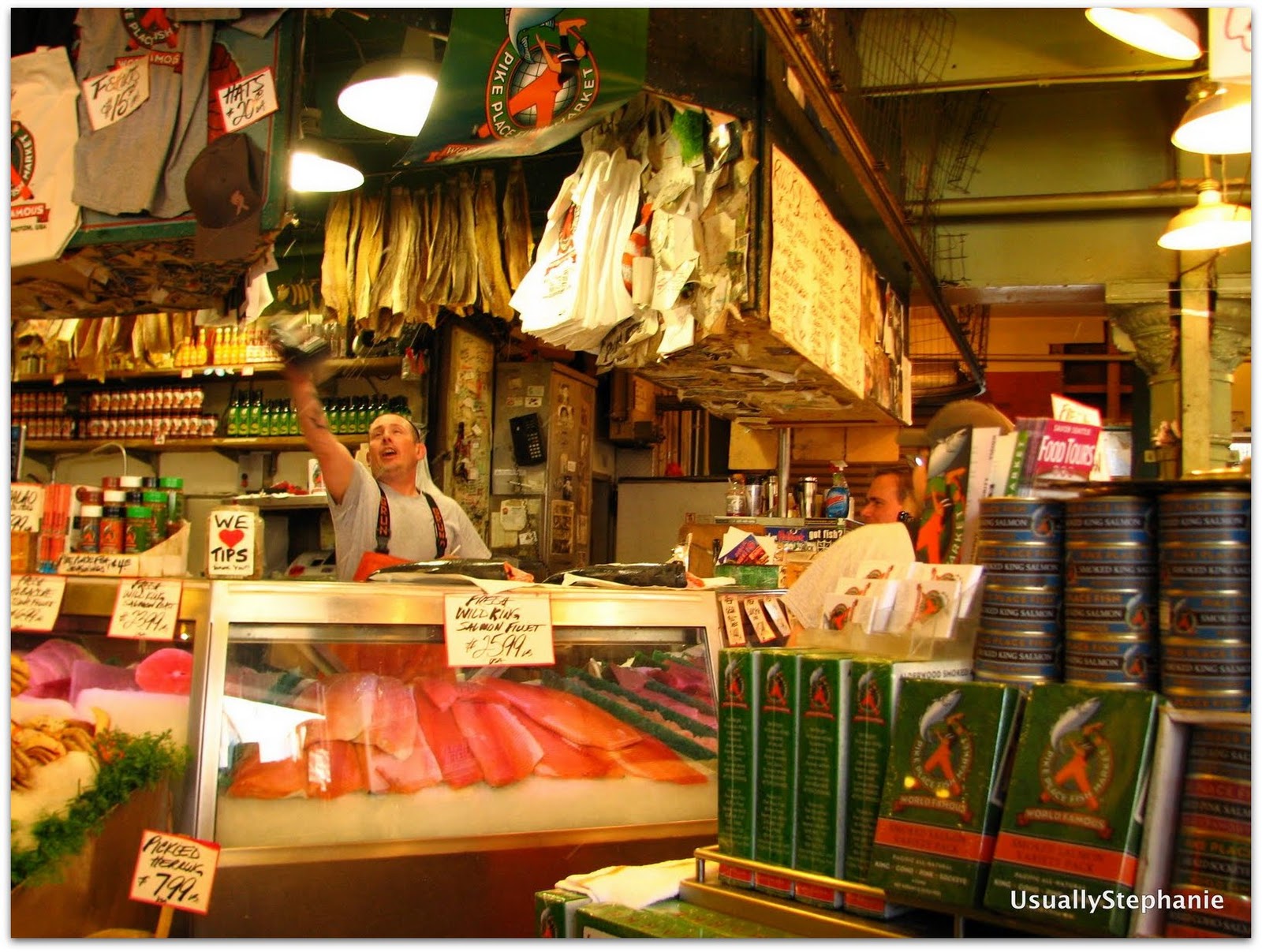
Catching fish at Pike Place Market.
In the morning, we took trips to the post office, where the Transporter sent home some souvenirs:  coffee for her supportive hubs and loot – lots of it – for her tyke, and to the bank.  Then the Transporter and I played tourist.  We took the bus in to Pioneer Square to hit the Klondike Gold Rush National Historic Park (another stamp!), strolled around in Pike Place Market (fish thrower guys), wandered by the original Starbucks, and took the Monorail to Seattle Center and the Space Needle (we did not go up).  After a little confusion, we found the right bus stop and headed back "home".
The original Starbucks storefront.
Bright and early the next morning, it was time for the Transporter to return to Mississippi.  After a few hugs goodbye at SeaTac Airport, she was on her way to her Southwest flight, and headed home. I was about to spend 6 months in Seattle.

Monday, August 23, 2010

Washington to Washington, part 3

(...continued from Part 2)


Day 6.  Cody, WY to Yellowstone National Park.

First things first:  we had breakfast at the Mayor's Inn.
Eggs Benedict at the Mayor's Inn, Cody, WY
Yum.  Then we set out for the Sierra Trading Post Outlet in Cody and gave ourselves a half hour limit.  The co-pilot (we has since told me she wishes to be referred to as the Transporter), being from Mississippi and about 15 weeks pregnant, needed some warm clothes for Yellowstone.  So we emerged with fleece, hats, and gloves.  Within half an hour.  And that included a foray to the skis section (there were only 2 pairs of skis there).

On our way to the park, we stopped at Buffalo Bill Dam and picked up a random stamp.  The dam is touted as the tallest at the time it was built.  Not to be a total PITA, but doesn't it seem like every dam was the widest, largest in volume, tallest or whatever superlative at the time it was constructed?  Just sayin'.

We entered Yellowstone NP through the east entrance and almost immediately encountered bottlenecking due to some bison that were hanging out in a field.  We had decided earlier that driving the entire Figure 8 would be ambitious, so we settled for the lower loop and skipping, among others, Mammoth Hot Springs.  Both the Transporter and I had been to Yellowstone previously.  In fact, it was the impetus for my 6th grade science fair project on geysers.  I [heart] gesyers!  

Anyway, our first stop in the park was Lake Village, on the north end of Yellowstone Lake, for a park stamp.  We made a stop at a geothermal spot, said hello to a bison that was just lying around (I am convinced they all drew straws that morning to see who would have to go out for the tourists), and I ditched the Transporter for a quick jaunt up a hill to see some geysers, passing more bison along the way.  
From there we went north to Canyon Village, for another stamp, and more importantly, lunch.

We continued counterclockwise to Norris, got a little disoriented – which is a little embarrassing because, the drive is, after all, a CIRCLE – and then headed towards Old Faithful, where we had a basic cabin reserved for the night.  The key to exploring Yellowstone by car, by the way, is to just duck into the side roads that may or may not be marked on the map.  They're less crowded than the main loop road, and often you'll be sharing geysers and thermal pools with less than 10 other people.
Hot spot on a side road
We made a quick stop at Madison Lake for a stamp (and begged the ranger to open the store for us to actually stamp our passports).  We also took in the view and chatted ever so briefly with a guy wearing an LSU hat and that the Transporter thought would be perfect for me.  Seriously, this guy looked like he was 21.  And we'd never see him again.

It was time for dinner at the Old Faithful Snow Lodge and then a night in our cabin.  Half the guide books we read said that the cabins were little more than a tent.  I don't know what kind of tent those writers have been staying in, but the cabin was sturdy and reminded me of the private cabins that my friends Elizabeth and Eric stayed in in Patagonia.  I mean, this cabin put to shame the sheet metal with exposed fiberglass hunting-shed-turned-"cabin" that I stayed in at a yoga retreat in West Virginia a year ago.  It's all relative.
Old Faithful Budget Cabin

 Day 7.  Yellowstone NP to Jackson, WY

At breakfast at the Old Faithful Inn Dining Room, we had noted the time of Old Faithful's next eruption and headed behind the geyser to Observation Point.  Let me just say, I don't hang out with many pregnant women.  And when I do, it's not to do physical activities.  Most of my pregnant friends, uh, go home after work.  Observation Point is a well-pitched incline up above Old Faithful and the geyser basin.  It's a more interesting view of Old Faithful than down where the bleachers are on the boardwalk.  The Transporter humored me.  Actually, she was humored because a family came up to the observation area, and she was convinced it was LSU boy's family.  Well, she was half right.  It wasn't his family, but LSU boy did show up.  And looked about 18 years old (he shaved this morning), and this time, the Transporter agreed.
Old Faithful Geyser from Observation Point
Old Faithful was on time, although the steam the geyser emitted sort of blocked our view. Which is just as well because all of my closeup photos from this were rather blurry, so you'll just have to settle for this photo. The trail to Observation Point heads out to Solitary Geyser, which was a treat, and then returns to the boardwalk where the masses gather. The boardwalk is an unfortunate necessity to viewing this particular geyser basin. Because we were doing merely a drive-by, rather than spending a significant amount of time in the park, it made sense for us to wander around with the masses. By the time we circled back, about an hour had passed, and Old Faithful was set to go at any minute. And we got a better view the second time around. Yay!

From Old Faithful, we set out to finish the loop. We had lunch near the Continental Divide and then picked up our last Yellowstone stamp at Grant Village before exiting through the South Exit toward Grand Teton National Park.  We drove down the John D. Rockefeller Memorial Highway that everyone exiting via the South Exit does. We caught our first glimpse of the Tetons as we made our way around Jackson Lake. We stayed west and headed to Jenny Lake, stopping at a viewpoint to walk down to the lake. Amazing, amazing views! We picked up stamps at Colter Bay Visitor Center, Jenny Lake Visitor Center and the fancy schmancy new Craig Thomas Discovery and Visitor Center in Moose Junction (there was also a girl in a prom dress there, but we'll ignore that because my brain can't process that).
Jenny Lake.
Lodging for the night:  the Lexington at Jackson Hole (we definitely paid for location), although its breakfast was pretty good; yummy dinner at Lotus Café.  We'd been traveling for a week!

(to be continued....)

Sunday, August 8, 2010

Washington to Washington, part deux

(continued from part one)

In late July, a high school friend and I set out for a drive from one Washington to another. Other than make it to Seattle by July 31, we had no agenda other than to stop at as many National Park Service sites – historical or otherwise – as possible. Here’s what happened…

Day 4:  Chamberlain, SD to Gillette, WY, via Badlands NP and Mt. Rushmore.  And Wall.

I have a soft spot in my heart for jackalopes.
Bellies full of hotel continental breakfasts and having decided to name my co-pilot's next child "Chamberlain" (not sure if the baby daddy is aware of this), the co-pilot and I set out for Wall Drug.  Yes, we actually put Wall Drug on our list of places to go, even before the first billboard in Worthington, MN.  Enough people exclaimed, "YOU HAVE TO GO TO WALL DRUG!" when I told them my route that I couldn't disappoint.  So, we drove past the Badlands to Wall for our free cup of water and other kitsch, which in my case means jackalopes.   Wall Drug, for the uninitiated is a mall of a tourist trap.  It's brilliant, actually.  A druggist and his wife purchased the pharmacy on the edge of the Badlands during the Great Depression.  Suffice to say, business was bad.  Then the druggist got the bright idea of posting signs that said, "Free Ice Water at Wall Drug!" or something to that effect, for miles up and down the highway.  Sure enough, all these parched motorists that would have otherwise driven right by the small town of Wall flooded in for ice water and probably bought stuff, too.  A tourist trap is born!

From there, we doubled back about 20 miles to the eastern entrance of the Badlands by Interior, SD.  First stop, some missile silo national monument, whose propaganda hasn't been updated since the Cold War.  Remember, the co-pilot and I are avid when it comes to collecting National Parks Passport Stamps.  I tried to watch the 80s-era video, which really should have been a filmstrip to have the best effect.  The co-pilot immediately walked out after stamping her passport.  So that was that.  Next stop:  the Badlands!
Yup, the Badlands are still a big pile o' dirt.
It was as I had remembered it from 30 years ago:  full of dirt.  This time, the co-pilot and I took the Badlands loop road, but instead of looping back on to the interstate like everyone else, we drove on nearly every unpaved Indian road in the area, to get to the second Visitor Center.  Of course, those roads aren't marked, so that was sort of challenging.  A white van followed us the entire way, which is notable because it turned out that the passengers were a church youth group from Baltimore.  Then we fell into another tourist trap:  Indian tacos.  Whatever.  It makes no sense that they were being sold in South Dakota, you know, home of the massive Mexican migration.  So here I was expecting warm fry bread goodness, and this thing was cooled fry bread with canned beans and store-bought salsa.  Sigh.
Indian tacos....tourist trap?
We took another unpaved Indian road towards Mt. Rushmore.  Then the strangest thing happened.  We crossed a busy state road, and the other side - I swear - was lush and full of evergreens.  I have no idea what happened, but it was a dramatic fauna change.

The town immediately outside Mt. Rushmore (Keystone) is utterly cheesy.  But the co-pilot was awed by the monument when we rounded a corner and there it was!  By the time we left the Badlands and arrived at Mt. Rushmore, it was nearly 7.  Nearly 7 is bad news in National Passports Stamp collector jargon because how many visitor centers are open after 7?  Well, Mt. Rushmore's is.  Yay!
"I don't like the way Teddy Roosevelt is looking at me."
From there, it was off to Gillette, WY, a 2.5 hour drive, most of it on lonely state roads, with small towns interspersed.  It was a long day – we didn't pull into Gillette until after 10pm.


Day 5:  Gillette, WY to Cody, WY, via Bighorn National Forest.

After the über long day the day before, the last thing I wanted was another long day. We set out again on the interstate before turning onto US-14 towards Yellowstone in Sheridan. I think we drove really close to windmills, too, although it seems weird to me now that I type this up that there would be windmills in Wyoming. Maybe I'm mixing it up with another state (we saw several trucks transporting windmill blades on Day 1, although if you ask me, I will tell you that I think the government is building something in the middle of the country).

Also, every single sign on the interstate for Yellowstone and Grand Teton National Park said that US-16 was the most scenic and safe route. This was confusing to us because the two roads reconnect a few hours outside of Cody.  US-16 may have been the safest route, but it must be something if it's more scenic than US-14.

The treat of the day was stopping in Dayton, WY, right before the Bighorn Mountains. We had lunch (although I ordered a whopping breakfast) at the Branding Iron Restaurant. The town was also celebrating Dayton Days and we had arrived just in time for the water fight, a fundraiser for the local fire department. Now, the co-pilot and I, for some reason, thought that the water fight was a water balloon fight.  Oh, were we wrong...
I guess drought isn't an issue, huh? So, that's a pony keg on a pulley, on a wire that's strung up between two telephone poles. Two teams of three wield a fire hose and use the spray to get the keg to the pole farthest from them. The Dayton water fight was pretty hard core and a full spectator sport. There were brackets of competitors (although I'm not sure if teams were actually seeded), a megaphone, bleachers, party tents, and a beer cart.

From there, it was a drive up into our first set of big mountains, the Bighorns.  And then a part of the road was under summer construction, unpaved, and re-routed.  After having driven 40 miles on dirt roads a day earlier, this was nothing.  Then, it was a stop at Shell Falls in the Bighorn National Forest.  This drive is, simply, gorgeous; I'd love to head back here and camp.
Shell Falls, Bighorn National Forest
From Shell, WY, it's a relatively quick jaunt into Cody, and we arrived well before nightfall and well in time for the nightly rodeo.  Yee haw.  We stayed at the Mayor's Inn B&B, just blocks away from the main (Sheridan) street, grabbed a coffee at the Rawhide Coffee Co., and then headed for el rodeo.  After a late night pizza, it was time to turn in.
Cody Rodeo!
To be continued...

Monday, August 2, 2010

Washington to Washington….Part 1

If you look at my profile, you'll notice an ambiguity in my location.  I've temporarily located to Washington State.  In late July, a high school friend and I set out for a drive from one Washington to another.  Other than make it to Seattle by July 31, we had no agenda other than to stop at as many National Park Service sites – historical or otherwise – as possible.  Here’s what happened…

Day One:  Washington, DC to Indianapolis.

Why Indianapolis?  Because I have family there.   The first few hours of the drive were familiar to me, as the route took me to the start of the 2008 Ragnar Relay in Cumberland, Maryland.  We then made our way into Pennsylvania and our first National Parks-related stop: Fort Necessity.  This is where traveling with a history professor makes one (me) realize how little one (I) knows.  Having lived the most recent dozen years below the Mason-Dixon Line, my instinct is that every battlefield is Civil War-related.  Apparently, there were other wars fought on this turf besides the Revolutionary War and the Civil War.  Who knew? (My co-pilot, that's who).

From there, we searched for a tavern on the Historic National Road, aka, Route 40, to have lunch.  We found one in Hopwood, PA, but upon closer inspection, we deemed the establishment sketchy.  I dunno….closed blinds around 1 pm on a weekday just ain’t right.  From there, we crossed the Allegheny Mountains.  Gah!  The Alleghenies were no joke – is there really no better way across them than to just go up and down and up and down like a yo-yo?  Once we got past them, we bombed through West Virginia and Ohio and finally arrived outside of Indy around 10pm.  The drive to my cousin’s house took us past fields in which hundreds of fireflies flashed, an amazing sight.  Of course, I then navigated us off course, onto a road that took us in between two very tall corn fields – think Children of the Corn.  Eek.  We turned around and eventually made it into the correct driveway.  Five states down, seven more to go.

Day Two:  Indianapolis to Waterloo, Iowa

My cousin has two beehives that feature queen bees Freddie Mercury and Cleopatra [edit: my cousin corrected me:  Cleo didn't make it through the winter, so the new queen is Nebuchadnezzar, of The Matrix fame].  I’ve decided that the former is the best.name.ever. for a queen bee.  I ventured to the hives to watch the bees get fed, and then it was off to Waterloo.  
One of my cousin's two bee hives.
The most memorable part of this drive was our search for a Starbucks, which we finally found in Champaign, IL. We also stopped at the Best Buy so I could join the 21st century and acquire an iPod adapter for my car stereo. I know. We already discussed how 1990s I am.  Other exciting news for the day was crossing the Mississippi and discovering that we were right on the path of an oncoming thunderstorm that may or may not have featured hail and flash floods. And we went to the Herbert Hoover National Historic Site in West Branch, Iowa. Oh yeah, and my co-pilot also had Broasted Chicken for dinner, but neither of us really had a clue what that was until we later Googled it. Broasting is apparently done under license from a private company and refers to a method of preparing fish, chicken and other meats by pressure cooking and deep frying. I’ll let you mull that over.


Day Three: Waterloo, Iowa, to Chamberlain, South Dakota

I thought the most exciting thing we would do today would be either driving through southern Minnesota or visiting the WORLD’S ONLY CORN PALACE! 
The Corn Palace.  You're jealous, I know.
What actually happened was way more exciting. After we left the Corn Palace in Mitchell, South Dakota, we watched the sky before us on I-90 develop a strange looking front. My co-pilot and I probably said something like “Look at that rain” half a dozen times to each other. When the NPR channel suddenly cut out, I joked, “I bet a tornado got them.” The next thing we heard was the circa 1993 dialup modem sound. This was not the first time one of my smart-ass comments turned out to be true: the emergency broadcast system rattled off a series of counties for which there was a tornado warning. We learned from the day before that knowing what county you’re currently in and headed toward was sort of important when it comes to weather advisories. In this case, our hotel was located in one of the counties in which there was a tornado warning.
Heading toward a crazy storm front.

Super. We pulled into our hotel in Chamberlain. Our itinerary said we'd be across the river in Oacoma because the prices of hotels seemed cheaper, but my co-pilot was enamored with the faux rustic cabin-esque façade of the Chamberlain hotel, so I booked it the night before. This turned out to be a brilliant decision, as the hotel was right off the interstate, and the tornado sirens started wailing about seven minutes after we arrived. We checked in, brought our bags to the room, and then promptly went outside to check out the storm because, you know, that's what we storm chasers do. Then we went inside and turned on the news. Yeah, there was a big red splotch on top of Chamberlain…

Checking out the weather on TV...
The hotel employees, two people who couldn’t have been more than 20 years old knocked on our (and everyone else's) door and ordered an evacuation to the first floor hallways. I was finally using my tornado safety skills I had learned in the one and only drill my school did when I was a kid! I pulled out some post cards, and on one, I scribbled, "We're in the hallway of our hotel with all the other guests, waiting out a tornado. Oh. The power just went out..."

We were able to leave after about 20 minutes, and anyone who's seen a storm like this knows that behind the front often lies gorgeous weather.  This was not an exception. My co-pilot and I drove into the sunset and had dinner at a family restaurant on the bluffs of Chamberlain. We also discovered that it would have been treacherous at best to get across the river to Oacoma in the storm.  

The rest of the night was pretty nondescript. Electric power returned to the hotel as we pulled into the driveway, and we watched the news, which featured some guy from Vivien, South Dakota, holding a softball-sized hail. A week later, we learned that the piece of hail was the largest ever recorded in the US.

Yikes.
To be continued...